Cluster RTK

Nistorescu Sorin

Active Member
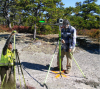
While systematic and correlated errors can be removed in single RTK systems, the uncorrelated errors degrade the RTK accuracy. Using a "cluster RTK" the uncorrelated (random) errors are reduced significantly.

Now, looking back to Triumph-4X and forward to Triumph-F1, there could be some links between them.

Triumph F1 can easily turn into RTK Base/Rover but I also believe it can become a real "cluster RTK" system with an option to change, in the field, the propellers with 4 GNSS antennas.

With several RTK engines, true 5Hz RTK rate, multiple baselines processed in every single RTK measurement and internal IMU, the sistem will perform better in bad canopy.
 

Nathan Waldren

New Member
Please elaborate on this. I mostly work under canopy (I'm a forester) and multipath is the bane of my existence. Any thing I can do to reduce that error is valuable.
 

Nistorescu Sorin

Active Member
Indeed, it is a nightmare to use GNSS receivers in bad canopy. Many discussions and a lot of beer was consumed on this subject.

Years ago, in one forest campaign, we decided to use rapid static and Stop & Go method with multiple bases (3-5 base receivers set in favorable places). No RTK technology at that time for us and we rely on our total station.

At post-processing moment we notice that we had more vectors in every point and more chance to obtain a fix. We spent hundreds of hours trying to remove outliers vector by vector. Somehow we managed to create pair of points (not exactly in the place where we needed, but in somewhat favorable proximity places) for total station orientation.

I think that Triumph-4X system may be useful in wooded areas because of multiple vectors that can create between base and rover. The chance to fix one of them increase. For GPS-GLONASS users, cluster RTK is a step forward.

In the near future the satellite signals will be more robust and powerful. Keep in mind that in other world areas, triple frequency GNSS receivers are already functional. For example we have 5-7 BEIDOU satellites every day in our area. Today another pair of Galileo satellites was successfully launched. So there is no magic solution for the moment in bad canopy. We must be patient, and the situation will improve.

Also I wonder how this Triumph-4X could work in a RTK++ scenario, in Justin software, with true 5Hz. Maybe someone on here can provide more data and perhaps some tests with this system.

Triumph-F1 could just add photogrammetry capabilities for this great Triumph-4X surveying equipment.

Regards.
 

Nathan Waldren

New Member
I'm using a T2 and NTRIP for corrections and have been mapping everywhere I go for some months now; as a result, I now have an ever-better map of where RTK does and does not work on and around this property. This is very time-consuming and is only a suggestion for any given point. Cluster RTK could shorten the process some as well as adding precision and accuracy for any given point. I really only need about 30cm accuracy but if I shoot for 1cm and get 50cm I'm happy.
 

Nistorescu Sorin

Active Member
Very important for us are some accessories like a good laser range meter. This kind of devices greatly helps in most situations combined with GPS cogo offsets functions.

So instead of forcing the receiver to obtain a fix in a bad place, we try to intersect the critical point from another two temporary points which provides a stable fixed position. In this situations the Triumph-4X base/rover system could be superior.

Leica DISTO with Bluetooth or even a HILTI PD-E, both with precise 360° tilt sensor and targeting system, can save the situation if we know how to make them useful.
 

Matt Johnson

Well-Known Member
5PLS
Very important for us are some accessories like a good laser range meter. This kind of devices greatly helps in most situations combined with GPS cogo offsets functions.

So instead of forcing the receiver to obtain a fix in a bad place, we try to intersect the critical point from another two temporary points which provides a stable fixed position. In this situations the Triumph-4X base/rover system could be superior.

Leica DISTO with Bluetooth or even a HILTI PD-E, both with precise 360° tilt sensor and targeting system, can save the situation if we know how to make them useful.

The CoGo Resection function was added specifically for this purpose. It uses 3 offsets. I have used it several times successfully to locate points near the trunk of a tree. I just use a tape measure to measure the offset distances but a laser range finder would work too and could be used for longer offsets. It should be fairly simple to remove the LS from the pole and then attach the DISTO to measure the distance.
 

Nistorescu Sorin

Active Member
Just for fun..
 

Attachments

  • Triumph-LS form factor.png
    Triumph-LS form factor.png
    2.6 MB · Views: 382

Nistorescu Sorin

Active Member
Triumph-LS could have multiple form factor very useful in various situations. Many of us have thought at least once to a GNSS device with laser offset. But in my opinion, integrating a laser in Triumph-LS is not a viable option. What I want to know if Triumph-LS has real heading capabilities or could be a part of a precise heading system.

On the other hand, Triumph-4X offer an amazing heading and pitch between base and rover with 16 baseline processed in every single RTK measurement. This is far beyond even from any actual competitor and the time seems that does not alter its capabilities. Still shines.

Third, I had the chance to look closer to that Caddy. I can tell that it is difficult to maneuver over obstacles and bushes.

So maybe a LITE heading and pitch version (base + two rovers) could help us better, with a DISTO attached and a simple sighting system with two notches (I have this to mine). Is it possible to overlap DISTO camera image with Triumph-LS screen by Bluetooth? How can we achieve precise heading-pitch and accurate relative positioning with a suitable tool for a surveyor?

With two receivers I am not sure for the distance between them in order to obtain a reliable Heading and Pitch (without IMU) and then take a DISTO shoot (Heading: 0.3/L [deg]; Pitch and roll: 0.4/L [deg], where L denotes length between antennas separation in meters).

With three multi-constellation receivers, we probably will be able to compute high accuracy heading and pitch, relative separation and positioning between rovers, baseline length and positions with respect to the base, then aim a target and take (multiple) laser shoot all just by a single touch.
The same statistical analysis from Triumph-LS could be applied to the final solution (maybe a KALMAN filter:
).

Regards.
 

Nistorescu Sorin

Active Member
Cluster RTK and also Heading systems are increasingly accessible to everyone. Surveyors are still looking for the optimal combination between RTK and LASER devices, but after a few years passing since 2015, cheap Heading RTK rigs have just appeared, proving that they can be good companions for the existing equipment (see them at Intergeo 2019 for the first time):

(part one, short)

I'm just thinking of a classic 2m rover rod (held horizontally) which could be transformed into a RTK Heading system using the LS, a monopod photo head (easy switching the LS from 0 to 90°), a second antenna (if supported by the LS) or a third party cheap RTK device, plus a Bosch GLM 50C LDM at the bottom part of the rod, all axial aligned to shoot trees, fence corners, power poles, light poles, etc. :

(part two, longer)

After shooting the offset, change the rover rod vertically and go on with classic RTK. Could be nothing but Javad performance power and precise/affordable Swiss technology.
 
Top