Hello. I have a Triumph LS/Triumph 2/HPT401BT. Prior to this last update, I've never encountered these issues checking into known points.. The horizontal is good, but the vertical is incorrect by a constant elevation. When I set up the RTK base unit, I always point stake to occupied base point, and the vertical and horizontal are good. But then, in the same session, I check into every known point (with a good fix and radio) on our baseline and we are always 5' high. I've double checked to ensure the points have been accurately edited to reflect differential leveling. I've also double checked to ensure the monopod rod height and units are correct. Any ideas?
You are using an out of date browser. It may not display this or other websites correctly.
You should upgrade or use an alternative browser.
You should upgrade or use an alternative browser.
Incorrect vertical when point staking known points.
- Thread starter Mike C.
- Start date
Could you attach your project archive or email it to me: mattjohnson00@gmail.com
In the Export screen choose "Project Archive File (ZIP)" format:

Or choose "Archive Current Project" from the Project screen (Collect>Project button):

Or choose "Archive Current Project" from the Project screen (Collect>Project button):
I got it. Where did the coordinates come from for design point 767? Are these from a different GNSS system?
I looked at your project (attached) and see that your base height has a 4.99 slant height. If you are sure that your elevations are correct it seems like there may be some bug that caused the base antenna height to not be applied to the RTK calculation which resulted in your RTK points being 5' too high. I will try to see if there is anyway I can reproduce it.
Have you had this problem on more than one project? Also after starting your base try staking out the base point. If there is a problem, it should be very noticeable by doing this.
Have you had this problem on more than one project? Also after starting your base try staking out the base point. If there is a problem, it should be very noticeable by doing this.
Attachments
Hi Matt. I'm positive the base height was 4.99' This is the only project where this has occurred, but it has happened several times within this project since the recent update. Prior to the update this issue did not occur. As a habit, I point stake my base point (and that's the confusing part, because at that point everything is fine), and it is only when checking into known control points that the issue becomes evident. I also want to add that the coordinate and elevation display at the very bottom of the screen also displays an incorrect elevation when checking in to said control points. Thanks again for your help.
I believe I may have found the bug that caused your problem. Did you happen to change General Group profiles after you started your base?
Hi Matt. I'm positive the base height was 4.99' This is the only project where this has occurred, but it has happened several times within this project since the recent update. Prior to the update this issue did not occur. As a habit, I point stake my base point (and that's the confusing part, because at that point everything is fine), and it is only when checking into known control points that the issue becomes evident. I also want to add that the coordinate and elevation display at the very bottom of the screen also displays an incorrect elevation when checking in to said control points. Thanks again for your help.
After thinking about it more I don't think it could be related to the General Group profile. It is very confusing if you staked your base point and everything checked. Did you do anything unusual between the time you staked base point and the other check points?
In your project I see you checked point 868 on the 13th but there is no base point in the database from the 13th. Do you know why? I see these points listed in chronological order:
Your project archive did not contain any raw data. Do you have raw data for the base and possibly rover points?
HI Matt. I routinely delete "base points" prior to exporting and downloading to the office. The issue has occurred several times across several days on this ongoing project. As a routine, after staking my base point, I check in to another known point to verify we are ready to collect data or stake. The Triumph LS has also frozen up and crashed since the update. Also, I assumed the export project would include RAW data. If you point me in the right direction, I will send it to you. Thanks again.
Attachments
Last edited:
Is there a document available describing the use of profiles?
I think Matt is updating it, but there is some info on pages 46-49 of the quick start guide. I recommend bumping the confidence levels higher than what is shown in the quick start.
http://www.javad.com/downloads/javadgnss/manuals/hardware/Triumph-LS-Quick-Start-Guide.pdf
HI Matt. I routinely delete "base points" prior to exporting and downloading to the office.
I would recommend not to delete them. They would help in troubleshooting and are required if you ever use DPOS. They can be hidden from the points list and exports if you use the "Hide Bases" filter:
Also are you using RTCM 3 corrections or some other format?
If you encounter this problem again please save both base and rover raw gnss data for troubleshooting.
Also I want to verify the general group setting Advanced/Units/Antenna Height should be set as Equal to Distance?
This would be your preference. If you want survey in feet but have survey poles graduated in meters you can set it to metric and enter antenna heights in meters rather than feet.
Hello again Matt. Thanks for the tip on hiding base and staked points, I will start doing that immediately. And yes, we are using RTCM 3.0 Min. I just returned from a site near our office and set up and checked into a known point (photo attached). Everything appears fine, so I'm assuming it's a corrupt project file? I think I'll start a fresh project and import the points from the problem project to see if that helps. Thanks again.
Attachments
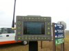
Hello again Matt. Thanks for the tip on hiding base and staked points, I will start doing that immediately. And yes, we are using RTCM 3.0 Min. I just returned from a site near our office and set up and checked into a known point (photo attached). Everything appears fine, so I'm assuming it's a corrupt project file? I think I'll start a fresh project and import the points from the problem project to see if that helps. Thanks again.
I don't see how it could be related to that project file. If you have the problem again the best thing to do is save the raw data so we could investigate it.
One more thing. Is there a way to be notified via E-mail prior to an update? Thanks.
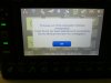
Currently we do not have email notifications. Whenever the LS is connected to the internet it will automatically check for updates and a sound will be played when an update is found along with the notification icon shown on the Support button.