Alexey,
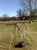
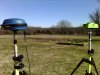
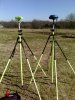
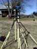
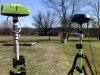
I collected this file a couple of days ago with a Triumph-2. It's a 20 hour file collected at 1 second rate. I sent the jps file directly to DPOS and I converted the jps file to RINEX using JPS2RIN and parsed the file to 30 seconds for OPUS. The receiver mount is a 5/8"x11 thread, so I threaded the adapter to the mount and the Triumph-2 to the adapter. I entered a height of 0.025m for both OPUS and DPOS. These are the results:
OPUS
REF FRAME: NAD_83(2011)(EPOCH:2010.0000) IGS08 (EPOCH:2016.0607)
X: -454272.367(m) 0.008(m) -454273.169(m) 0.008(m)
Y: -5373356.057(m) 0.001(m) -5373354.609(m) 0.001(m)
Z: 3394830.308(m) 0.002(m) 3394830.141(m) 0.002(m)
LAT: 32 21 57.50368 0.003(m) 32 21 57.52300 0.003(m)
E LON: 265 10 3.40119 0.007(m) 265 10 3.36596 0.007(m)
W LON: 94 49 56.59881 0.007(m) 94 49 56.63404 0.007(m)
EL HGT: 96.469(m) 0.001(m) 95.218(m) 0.001(m)
ORTHO HGT: 122.842(m) 0.012(m) [NAVD88 (Computed using GEOID12B)]
UTM COORDINATES STATE PLANE COORDINATES
UTM (Zone 15) SPC (4202 TXNC)
Northing (Y) [meters] 3582478.327 2083571.698
Easting (X) [meters] 327599.474 945090.941
DPOS
REF FRAME: NAD83(2011)(EPOCH:2010.0000) IGS08 (EPOCH:2016.0589)
X: -454272.368(m) 0.001(m) -454273.170(m) 0.001(m)
Y: -5373356.068(m) 0.001(m) -5373354.620(m) 0.001(m)
Z: 3394830.317(m) 0.001(m) 3394830.149(m) 0.001(m)
LAT: N 32 21 57.50373 0.001(m) N 32 21 57.52303 0.001(m)
E LON:E 265 10 03.40118 0.001(m) E 265 10 03.36594 0.001(m)
W LON: W 94 49 56.59882 0.001(m) W 94 49 56.63406 0.001(m)
EL HGT: 96.482(m) 0.002(m) 95.231(m) 0.002(m)
ORTHO HGT: 122.855(m) 0.002(m) [NAVD88 (Computed using GEOID12A)]
UTM COORDINATES STATE PLANE COORDINATES
UTM (Zone 15) SPC (NAD83(2011) /4202 Texas North Central)
Northing (Y) [meters] 3582478.329 2083571.700
Easting (X) [meters] 327599.473 945090.941
Historically, this point has been observed to have coordinates of
N 2083571.680m
E 945090.928m
H 96.450m
Texas State Plane Coordinate System 1983, North Central Zone. Ellipsoid Height.