Darren Clemons
Well-Known Member
...warning...only Javad users may enter!
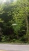
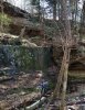
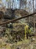
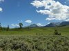
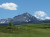
We had about 2500' of this creek to locate - a good bit of it right up next to a large cliff.....used 2 LS's and hopscotched each other.
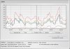
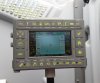
Had about 5 shots that we had to store PPK shots (all five of them we ended up having at least a few epochs of good RTK)
We had about 2500' of this creek to locate - a good bit of it right up next to a large cliff.....used 2 LS's and hopscotched each other.
Had about 5 shots that we had to store PPK shots (all five of them we ended up having at least a few epochs of good RTK)


")