Patrick Garner
Active Member
Two days ago when I was conducting a condominium development as-built. Set the LS up as shown... about 35 seconds went by... then the epochs started rolling it. I was astonished.
awesome...Marking out ice rinks for a local outdoor tournament.
Not difficult, just scenic.
View attachment 8236
And the end result that year
View attachment 8237
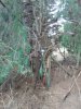
That one was easy.Nice. Can you spot my LS clicking its little heart out in this thick stuff?View attachment 8473