K Davis
Member
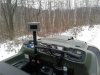
I'm planning to topo about 33 acres of open field with an ATV staying on grid lines 50 feet apart with a shot every 25 feet. I've researched some threads on here and found some going back to 2016. Can someone link to a more recent thread discussing setting up the LS for this? Will be my first time doing this. The topography is a gentle slope with almost no features (cropland).
I want to autostore every 25 feet but also stay on predetermined imported grid lines. Any help would be appreciated!
I want to autostore every 25 feet but also stay on predetermined imported grid lines. Any help would be appreciated!
")