Waas float processing

Alexey Razumovsky

Well-Known Member
JAVAD GNSS
5PLS
I had a similar situation a week ago here in the UP of Michigan. I had to locate a corner in a not so nice a location that I never wanted to go back to again.
I set up my base (T3 with 35 w radio) and clawed my way through brushy ravines to the 1/4 corner I needed to locate. When I got there, I had no radio link. No problem, I had contingencies. I had a Topcon Hiper Plus running on a known point a couple miles away that I could post process with Post-Processing software to, along with the T3 base. I set up the LS and ran about an hour of WAAS float. The area around the corner was not that thick so I thought I was good. Then I discovered that my Topcon Base had a hiccup and thought it was 1988. No problem, I would DPOS my T3 base and Post-Process from that to the corner and also DPOS the corner session as a check. Again, everything failed. As luck would have it, all the CORS stations within a fifty miles were down that day. (October 5). After reading this post, I tried the procedure described by Nate. Again, no luck. I got a "Failed (No solution for this vector.) Is there anything left to try, or was October 5th just the GPS day from hell?
Hi Joe, if you share the rover and base files we will try to help you
 

JoeD

Member
Hi Alexey,

My files were too large to attach here so I uploaded my project to support from the LS.
1174 was the base I used for the day (Oct.5).
1176 is the corner that I ran a 1 hour session on. Ran another shorter session on 1175 on a nail 6.4 feet away from 1176.
Also that day I was set a control point 1177 which I later (Oct. 7) used for a base stored as 1181.
Thanks,
Joe
 

JoeD

Member
Yes. I am 793. I am soon to be out of internet and cell phone range but will check back in tonight. Thanks
 

Matt Johnson

Well-Known Member
5PLS
I'm thinking if you could fractionate that 1 HR file, into 5 minute segments, and process them individually, you may have what you want/need. Probably discard some of those 5 minute ones too. 5x12 is 60. So, you could get several of those files to yield the truth.

RTPK automatically divides the file into segments. Preliminary data filtering, outlier rejection and cycle slips detection is done on the entire file and then it is split into segments for ambiguity fixing.
 

Jim Frame

Well-Known Member
Your Topcon probably just recorded the wrong date because its firmware couldn't accommodate the GPS week rollover. You can convert to rinex and change the date in a text editor, and it'll probably be fine.
 

Nate The Surveyor

Well-Known Member
Alexey, it would be sorta handy if you’d post a brief outline of the steps you did.
others will want to do this in the future. You are much appreciated. But if we can do this ourselves, it might spare your time.
Again, it’s appreciated. Thank you.
nate
 

Alexey Razumovsky

Well-Known Member
JAVAD GNSS
5PLS
Nate, there are enough data in rover files. I just split data into multiple pieces where graph shows better residuals. For each vectors I have 5 time separated independent solutions that agree within hundreds. Than adjustment.
 

Nate The Surveyor

Well-Known Member
Ok. So, Justin software was your tool. Can you share a few things it can do?
If I bought a copy of Justin, would it be able to do what you did, or is yours different?
Thank you,
Nate
 

David M. Simolo

Well-Known Member
One note: 'reset tracking' isn't good idea if you are going to RTPK data
I do this quite regularly in canopy during longer sessions. Does it create bad results or just make good results harder to come by? Does it only impede the current round of RTPK that will be processed next? Any other comments you care to make about the details of this?

Thanks Alexey.
Dave
 

Alexey Razumovsky

Well-Known Member
JAVAD GNSS
5PLS
Reset tracking splits data into independente segments. We beleive it may help RTK to reset false ambiguity initialization. In the meantime reset tracking harms RTPK because RTPK inself splits data into segments using raw data evaluation. If both splitting aren't synchronized it leads to double splitting of raw data.
 

Steven hill

New Member
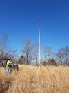
Another thing. Go buy a cheap painters pole. Drill out the top, and install a piece of 5/8 x 11 bolt. Elevate base UHF antenna as high as you can.
Rtk and RTPK both will be better.
N
 

Attachments

  • 20220228_082224.jpg
    20220228_082224.jpg
    2.2 MB · Views: 199

Steven hill

New Member
OK, first off, think in terms of Base to Rover processing. WAAS float is a part of the Javad Philosophy of giving you the BEST answer as fast as it can. So, it gives you a coordinate that is often within 5 or so feet.
But, now we are going to BASE to ROVER processing.
So, AFTER downloading the BASE file to Rover.
Press POINTS. Highlight the point that was processed via WAAS.
Then press the 3 bars. (resource button) then Right arrow twice.
Then press Post Process selected point. It will now process the point.
Now, be sure to select the RTPK value, over the RTK point. The RTK point I believe is the WAAS or field point. The Post Processed RTPK point is the good one. You generally will want to make 3 shots, maybe of 5-8 minutes each. This will usually give you three points that agree within a few hundredths.
Anyway, This is a great function.
Nate
I came to a spot out in the woods where i had radio up until i was about 400' away from my objective ( an old school property) where US forestry will surround it. Lost all radio; shot 2 corners as well as center of depression where privy once stood using WAAS float. This was my test opportunity. Did 5- 10 min. occupations on corners and 3- 10 min. on privy. Estatic with my results! Had all but 2 within 0.04' from first shot on each corner. Highly impressed.
 
Top