The Pincushion Effect

avoidthelloyd

Active Member
I'm currently reading through The Pincushion Effect by Jeffery Lucas. You guys that have read it have any thoughts? If you haven't read it, what are your thoughts about the multiple monument dilemma at or near boundary corners, e.g. finding a 1/4" rebar, 3/8" rebar and 1/2" rebar all within 2 feet of each other in the intersection of a roadway where a section corner or boundary corner is located.

I know for me, I was trained by my boss as a 'deed surveyor'. It wasn't the surveyors job to determine who owns what, but to simply mark the deed as written on the ground and note any encroachments. Since I have had my own business, I see the unavoidable issues in this way of thinking.

What would cause any surveyor to set a new monument so close to one already there?

Is this a failure of our profession (in my area anyway) to leave enough evidence to be followed?

In Oklahoma, we do not file our surveys for public use. That would really help, but I only have 6 years of work to contribute and the older fellers may not want to give away what they worked hard for?

Would access to all the surveys even help this problem? Is it a matter of showing field vs. record dimensions on our surveys? Does that appease both the neighbor by only marking the one monument as well as the title work folks who need the numbers to match previous records?

I know I can retrace one of my surveys later and measure differently the second time due to many variables.

Thoughts?
 
Last edited:

Adam

Well-Known Member
5PLS
Deuteronomy 19:14

“You shall not move your neighbor’s boundary mark, which the ancestors have set, in your inheritance which you will inherit in the land that the Lord your God gives you to possess.

I think this verse answers some of that.
 

avoidthelloyd

Active Member
Deuteronomy 19:14

“You shall not move your neighbor’s boundary mark, which the ancestors have set, in your inheritance which you will inherit in the land that the Lord your God gives you to possess.

I think this verse answers some of that.
Some of it, maybe, but the issue is when the original monument has been gone and the position poorly perpetuated, why are we getting multiple monuments set back? I can even see that the BLM manual methods would fall short when other dependent monuments themselves are also being disturbed. It's difficult.
 

Adam

Well-Known Member
5PLS
It's a mess out there for sure.

It's evident every time you find two monuments where there should only be one.

Here is the thing. If our shovels were used more than our hammers along with a little of the verse above we would be much better off.

But, what about the iron that is 2' tall and off 9' from where it should be when all the other corners are hitting within a tenth and flush?
I think it has been relocated at some point. I will never know though so I showed it on the map with a note explaining the evidence.
It was an adjoiners corner in my clients line so I did not set another corner. It's all we can do.
 
Last edited:

Adam

Well-Known Member
5PLS
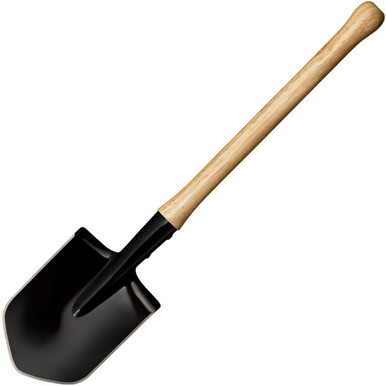
Speaking of shovels.

I purchased a Spetsnaz shovel and it is fabulous.

Some of my long-time friends will appreciate that I'm complimenting the LS with a shovel designed in the same area of the world.


avoidthelloyd

Active Member
Speaking of shovels.

I purchased a Spetsnaz shovel and it is fabulous.

Some of my long-time friends will appreciate that I'm complimenting the LS with a shovel designed in the same area of the world.

Cool. In my neck of the woods, our shovels aren't used a lot. We use picks and bars and an occasional spade if needed.
 

Bill Eggers

Active Member
Yes, this pincushioning, whether actual or virtual, is a huge problem everywhere. It was exasperated by the philosophy of the surveyor must follow the deed. Of course the lawyers and title people want the numbers to remain the same so they can easily determine that it is the same property. I don't have a problem "breaking the record" based on new measurements to old monuments. That's what we do! Retracing the footsteps (monuments and evidence) of the original surveyor. That takes work and effort. It's relatively easy to just lay out the deed dimensions with current technology. The "black box" will give you an answer! Primary tools for a surveyor are the ability to observe and think, use that.
Our surveys are generally not of public record either, that's a problem.
 

avoidthelloyd

Active Member
Yes, this pincushioning, whether actual or virtual, is a huge problem everywhere. It was exasperated by the philosophy of the surveyor must follow the deed. Of course the lawyers and title people want the numbers to remain the same so they can easily determine that it is the same property. I don't have a problem "breaking the record" based on new measurements to old monuments. That's what we do! Retracing the footsteps (monuments and evidence) of the original surveyor. That takes work and effort. It's relatively easy to just lay out the deed dimensions with current technology. The "black box" will give you an answer! Primary tools for a surveyor are the ability to observe and think, use that.
Our surveys are generally not of public record either, that's a problem.
That's it! I think having both the measured and record dimensions on the plat and teaching the title folks which to look for to help them is beneficial. A lot of the issue in my area is when a surveyor (usually out of state guys who obviously don't care) goes to a corner and just does crappy work or puts no effort to recover the previous position and sets a new monument. Such a pain to follow up.
 

Monte King

Member
There are situations that require the setting of another monument but they tend to be the exception. Very broad subject for sure!

In many cases it comes down to lack of effort and/or misunderstanding/misapplication of principles for a particular situation. The example of multiple irons marking a road intersection as the section corner is a good example of misunderstanding/misapplication of principles. The road intersection is the best available evidence of the original section corner, however determining a finite position is required for surveying. Every surveyor is going to determine that intersection, especially rural with no R/W monumentation, at a slightly different finite location. The first iron marking the intersection should be accepted as the finite location of the "intersection" unless it has gross error, ie nowhere near the actual intersection taking historic road movement into consideration or lack of considering all available evidence. For some reason some surveyors feel the need to "perfect measure" the intersection without considering evidence at the time concept. The first iron was set based on the evidence available at the time, which considering measurement error and subjective nature of the evidence (R/W and/or road bed), is the best available evidence of the historic intersection at that time. Of course there are times that certain pieces of evidence were not considered at the time of the first iron being set so things could change depending on the evidence. This is why as surveyors we need to do our due diligence and uncover all pertinent evidence at the time of our survey. We need to be able to concisely articulate why we made the decisions and what evidence was used at what weights. This same idea applies to restoring original corners from Bearing Tree/Object evidence. If you are working with the same evidence as a previous surveyor but you determine a position slightly different then it is best to accept the previous work under the concept of "proper procedure within tolerances of the time."

In PLSS, one of the most misunderstood aspects is when corners are (re)established from certain control and a later survey uncovers original evidence that conflicts with a controlling corner used in the previous survey. Technically the corners reestablished from the erroneous control should be rejected, including PLSS aliqout part corners, and new ones set utilizing the correct controlling corners/evidence. If it is a Fed boundary then the landowners have little recourse but if private all around then they can take actions such as boundary agreements or claim unwritten rights. It becomes a property line vs title line situation that can only be remedied through land owner acquiescence to the survey or courts. In many cases the surveyor leaves and the landowners live to the already established occupation lines ignoring the survey monuments. This just shows that "retracing" surveyors don't actually establish boundaries, we provide opinions but the landowners are the ones that actually establish the boundary by accepting the surveyor's work and occupying to it. Again, Fed boundaries are a little different ballgame when it comes to the concept of landowners establishing the boundaries...

I understand where Mr. Lucas is coming from. I don't necessarily disagree with everything he says but when it comes to Fed boundaries I do tend to disagree with him due to my extensive experience in them.

I could go on and on getting into 1805 Act and so on but it would take quite the post LOL
 

avoidthelloyd

Active Member
For some reason some surveyors feel the need to "perfect measure"
The viewpoint that math is the solution is a problem... especially MY math. There is a reason that proven monuments have more weight than measurements in the hierarchy (1805 Act). I appreciate the feedback.
 

Darren Clemons

Well-Known Member
Lucas’s book is outstanding. I’ve read it and passed it on to several over the years. I agree on all the points made and I am definitely not a fan of pincushion corners. I’ve always felt it makes us, the surveyor, look ridiculous to be honest. I agree there ARE instances, albeit very few of them, where a second corner very close to an existing one should be set.

However, I agree with Monte in that my belief is most surveyors that do this on a regular basis feel like they are “expert measures” and completely miss what they’re “supposed” to be doing - retracing the steps of the previous surveyor. They either don’t understand or just ignore that ALL surveys from the beginning of time have human error in them, it’s just part of surveying. It seems to me ones who do this want to make things a —-ck measuring contest. For instance, I did a survey about 12 years ago (yes, I remember this one very specifically) and about 4 years later a fellow surveyor came in and divided out a parcel from it. This was not an ALTA but merely a boundary plat, but every single line was labeled “deed (my original measurements)” and “measured” (his new measurements) on the calls. The differences were from 0.01’ to 0.04’ on every line.

I work in Kentucky so I don’t deal with the section corner issue which I know is a completely different animal. All my deeds are typically old pole measurements and in these cases I’ve seen most surveyors (including me) set the two corners of a 100 pole line at both established fence corners that are, let’s say, 1645.60’ apart. “Some” surveyors will set those two corners at 1650.00’, either 5’ from one of the “obvious“ corners or 2.5’ from both obvious corners. All this does is have the potential to cause an issue that isn’t there. Common sense is a HUGE part of surveying in rural Kentucky! The type of property boundaries and where they are make a big difference in how/what to do with error. As Monte said, Fed boundaries are a different ballgame altogether.

Believe it or not, there is a surveyor in my area, that I have many times found his own caps side by side literally touching each other on a particular corner in a random subdivision. When I asked, he knew he’d set two in the same spot and rationalized that when he did one lot and adjusted one way he got pin #1 location and when he did an adjoining lot some time later he adjusted from different found corners and came up with pin #2 location - about 0.11’ apart. I don’t and never will understand that kind of logic.

The most I’ve seen in my career is 4 pins - all with a different surveyors ID cap - on the same corner. I could’ve put a coffee can over the top of all 4. The worst “issue” with those type corners is now what I have to do. I have to decide which of the 4 I feel is the true corner and annotate my plat with ridiculous reference lines all over it to explain what I found. Totally unnecessary and, like I said, makes surveyors look ridiculous in that even we can’t “agree” on where the corner is.
 
Last edited:

avoidthelloyd

Active Member
retracing the steps of the previous surveyor.
Thanks for the comment. I think I was trained up to pacify the title folks and the dimensions on the survey needed to match the deed calls. We did this and showed how far off any pins we found were from the corners. What I didn't realize years ago was that in pacifying the title folks, we were aggravating the land owners and neighbors. Why did I not consider the land owner first? Shouldn't the land owners have primary consideration if one of our objectives as professional land surveyors is to promote public interest?
 

Donald E Robinson

Active Member
I'm currently reading through The Pincushion Effect by Jeffery Lucas. You guys that have read it have any thoughts? If you haven't read it, what are your thoughts about the multiple monument dilemma at or near boundary corners, e.g. finding a 1/4" rebar, 3/8" rebar and 1/2" rebar all within 2 feet of each other in the intersection of a roadway where a section corner or boundary corner is located.

I know for me, I was trained by my boss as a 'deed surveyor'. It wasn't the surveyors job to determine who owns what, but to simply mark the deed as written on the ground and note any encroachments. Since I have had my own business, I see the unavoidable issues in this way of thinking.

What would cause any surveyor to set a new monument so close to one already there?

Is this a failure of our profession (in my area anyway) to leave enough evidence to be followed?

In Oklahoma, we do not file our surveys for public use. That would really help, but I only have 6 years of work to contribute and the older fellers may not want to give away what they worked hard for?

Would access to all the surveys even help this problem? Is it a matter of showing field vs. record dimensions on our surveys? Does that appease both the neighbor by only marking the one monument as well as the title work folks who need the numbers to match previous records?

I know I can retrace one of my surveys later and measure differently the second time due to many variables.

Thoughts?
In Palm Beach County, FL we found 4 section corners in the intersection of two major highways. I was told that a county engineer decided the original corners were wrong and set new corners leaving the old ones in place. So, depending on which section you were working in, you would use the "published" monument for that section. A sketch of the monuments, showing their location relative to the other three section corners, were attached to the document. The further west you would go the corners were further apart (as much as 400'). This created a real problem with deed description if you used the wrong section corner.
 

Shawn Billings

Shawn Billings
5PLS
Retracing the Deed is important, but I think the conflicts come from the question of what does retracing the deed mean?

A few years back I surveyed a 250 acre tract. The west line was on an original grant line (I work in Texas where land was granted by metes and bounds). The original grant line was about 5500 feet long and my tract was roughly in the middle of that line. I found an iron stake at my Southwest corner that was about 4-5 feet East of the straight line between the monuments I found on the original line. I made the decision at the time to call this monument at my Southwest corner for reference, creating a "virtual corner" 4-5 feet to the west. In retrospect I would not make that same decision today. That iron stake was likely set in the 1950's. I have to ask myself, was that stake reasonably on the line using the technology in 1950's by a surveyor surveying a rural tract? Yeah, it was. It makes no sense that boundaries should move simply because the measuring technology improves over time. This is why there is such an important focus on monuments. A property owner can't see the difference in 100.5 feet and 100.3 feet. But he can see the monument.

So any time I survey now, the question I have for every monument I find (original or otherwise) is "does this monument substantially represent the boundary?" If every monument in the survey is within 0.5 feet of called measurements and I find one that is off by 3 feet, I will likely reject that one, unless it's clear why the monument is off by that much. I may also hold the monument if it has been acquiesced to (e.g. a fence was built to it).
 

avoidthelloyd

Active Member
using the technology in 1950's by a surveyor surveying a rural tract
Hey Friend. This is another great insight. Today, if we went out to survey using a chain (or even a tape) and traversing through the terrain and we got within 5 feet of an exiting iron stake, you bet we would use it! We would be happy to have gotten that close! This flow of thought does help one see the high value of existing monumentation. You are right again, the land owner can see the old monument and probably take you to more of them on their place. Great observation. It may help the situation to start discussing HOW to show the discrepancies between the record information and the measured information on our surveys.

I just did a survey a couple weeks ago close to the Arkansas line and here in Indian Territory, those are the oldest towns and populated areas. This was a subdivision done a long long time ago on hilly terrain and as you might expect, the monumentation does not match the platted dimensions of the lot lines. What to do? Well, most of the monuments were the same type of old pipes (easily available back then) and they have been yielded to for many decades now. As you mentioned, I would not expect them to be able to accurately measure horizontal distances easily with a steel tape on hilly ground. When we chained up and down hills and used our cline tool to compensate for verticals we were not going to get to the nearest tenth.
 

Greg Flowe

Active Member
Especially along time ago the surveyor may show up and the property owner is his helper for the job and accuarracy was not neccessarliy as important as it is today. On mountain terrain alot of times you find the distance matches closer if you measure with the slope and not so much horizontally.
 

Randy Hepworth

New Member
I highly recommend Jeff Lucas' newsletter- The Lucas Letter. I have been surveying for 50 years, started my business in 1979. Been around long enough to see technology change from Transit & Tape (with the dip needle! remember those?) to theodolite & EDM to Robotic Total Station to single-frequency GPS to RTK and now JAVAD. However, technology changes should not (better not) result in changes to boundary markers. Lucas has been instrumental in changing my perspective and approach to Boundary Surveys. I use to be the deed-stakin-est 'deed staker' there was. Year's ago, It was always an issue to me that many times my surveys were not actually solving any problems- only finding them! What good is that? After taking Jeff Lucas' Master Boundary Survey on-line course, he greatly changed my way of thinking. As a Surveyor, I am doing only one of two things: either I am an Original Surveyor marking the boundaries of a new parcel within a larger parcel, or I am a Retracement Surveyor finding, measuring, retracing the boundary that already exists on the ground. It is not Retracement Surveying to simply layout the math of a deed on the ground - anybody with a bit of math capability and high-precision JAVAD GPS can do that- all we need is 2 control points and an azimuth. What good is, or need for a surveying license then? If as Professional Surveyors we do not change our thinking on this issue, we will lose our niche- being the only ones with the authority and right to locate land boundaries on the ground. Maybe, we are well on the way to that happening- I meet people every week who claim to have expertise with their high-precision smart-phone GPS, and you probably do too. I now happily enjoy being able to solve land boundary problems that only 20 years ago I would probably have simply shrugged my shoulders, and set another iron because the one found didn't fit the math. Oh, boy- I sure wish I knew then what I know now with 50 years' experience and hard knocks, and more than just a couple of court battles. One thing I have observed in court- Judges DO NOT like to upset the status-quo! Why in the name of common sense do I want to send the parties to a boundary battle in court. You, Mr. Surveyor, should have the knowledge to avoid sending people to court- use it. As far as those who say the BLM Manual is the only way surveys are to be done, I wonder if they might have neglected to read Chapters 3 and 5? The issue that we are discussing in this thread is well discussed in the manual. Jeff Lucas has much to say on that subject as well- again, I highly recommend his newsletter.
 

Monte King

Member
I have to agree that the BLM manual is not the only way to survey. It is actually purely a guide for fed surveyors. As stated above I don't necessarily disagree with many things Mr. Lucas speaks to, except when it comes to Fed Lands. My reasoning has nothing to do with the Manual or agreeing with the "perfect measurer" syndrome (I firmly disagree with perfect measurers reasoning/excuses). My reasoning is based on my understanding of the pertinent laws and case law when dealing with Fed Boundaries.

When it comes to section subdivison it is my understanding from state case law (some in AL) that it is clearly understood that a judiciary can not adjudicate title lines in a different location, using adverse possession and the likes, that have been established (contemplated) in law. They seem clear that the PLSS aliquot sub lines are applicable to the statement. In other words adverse possession and the likes do not move the title line (PLSS) but nonetheless are considered the true boundary as adjudicated.

Quote from: Supreme Court of Alabama - 367 So. 2d 944; 1979 Ala.
"Our cases are clear that no agreement or act (e.g., adverse possession) of adjacent landowners can relocate the section lines, or interior subdivision lines established by government survey, for they are certain in legal contemplation. Sims v. Sims, 273 Ala. 103, 134 So.2d 757 (1961); Upton v. Read, 256 Ala. 593, 56 So.2d 644 (1952); Alford v. Rodgers, 242 Ala. 370, 6 So.2d 409 (1942)"

I have to ask myself, if under its own admittance, a court cannot adjudicate the location of a PLSS title line then how can a surveyor (BLM or otherwise) have that authority?

The courts do not seem to question the procedure for subdividing secs. They seem to be pretty clear that if the title originated from a patent then the survey plat, field notes, and pertinent laws, are attached as if written on the face of the patent itself. The 1805 Act is clear on the procedure to sub secs. The common grantor aspect of common law is what it is all based upon. A landowner of a large tract can subdivide it and convey however they choose. For Gov disposals, the sec exteriors were surveyed as desired and the subdivision was completed via platting and laws. The first patent issued in a section locks in the subdivision according to the latest survey and laws. To truly protect the Bona Fide Rights of all of the individual patentees of a sec then it should be subdivided according to Fed law if conveyances are being made based upon the aliquot part descriptions.

A statement from a sec sub presentation that a Cadastral Surveyor did about 15 years ago:
"The courts recognize the shortcomings of these sectional subdivision surveys and apply legal doctrines such as, practical location, adverse possession, agreement, acquiescence and lately, the doctrine of repose, in an effort not to disturb existing marked boundaries that may not have been located as contemplated in federal statutes and as depicted on the official plat. These doctrines are not operative where parcels of original public domain have not been disposed of by the government. It is to be noted also that court-determined boundaries are not necessarily the legal subdivision lines of a section as defined by law."

As we all know measurements are not perfect. If ever evaluating a subdivision with Fed lands involved it is good practice to evaluate any recovered monuments/surveys under the "used proper procedure and within tolerances" test. The proper procedure seems obvious, but the typical hang up is the old question of "what is close enough," this requires the "tolerances of the time" statement to be defined as it is subjective. In PLSS I personally treat all surveys/surveyors exactly the same in this test. I use the GLO manual in effect at the time of the survey. Of course the 2009 Manual tolerances are likely looser than the particular state when looking at recent surveys, but if I were ever pressed by a court I can explain my process and show equity in acceptance/rejection. I also apply the consistency evaluation like Shawn. Every situation/survey is different for sure. Steve Hansen wrote up a presentation handout years ago (2005 I think) and it is a great run down of the sec sub debate.

Love these subjects and I hope I do not come across as defensive or anything like that!! Fun discussions!!
 
Top